|
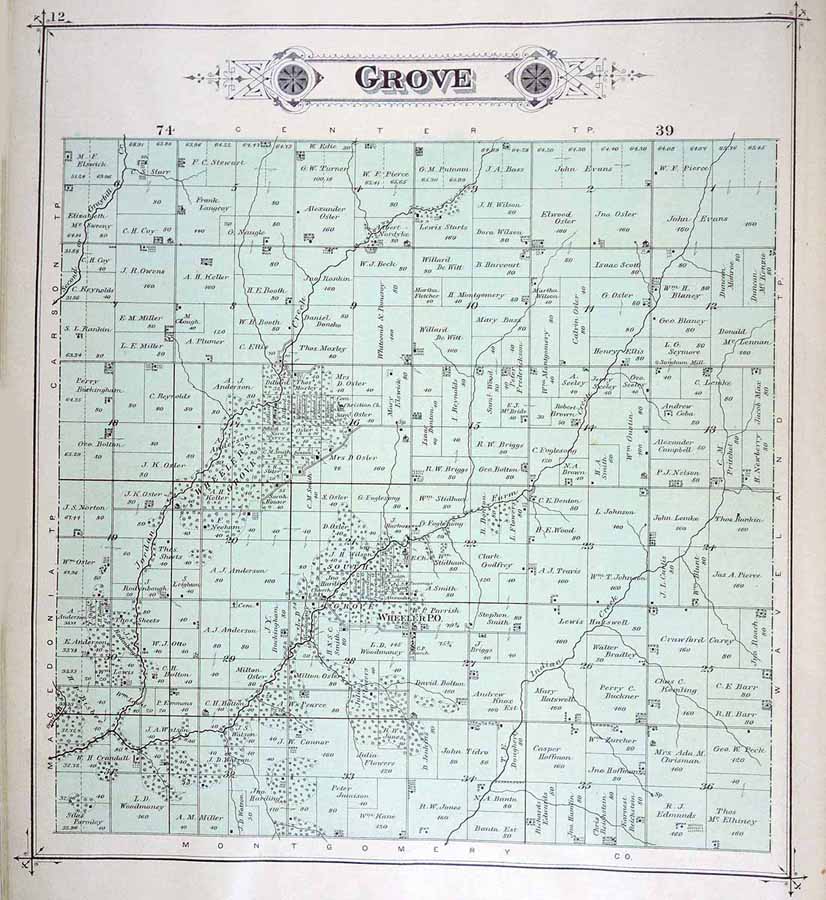
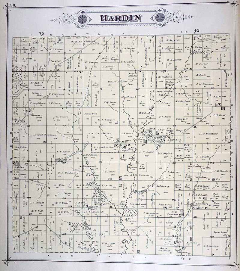
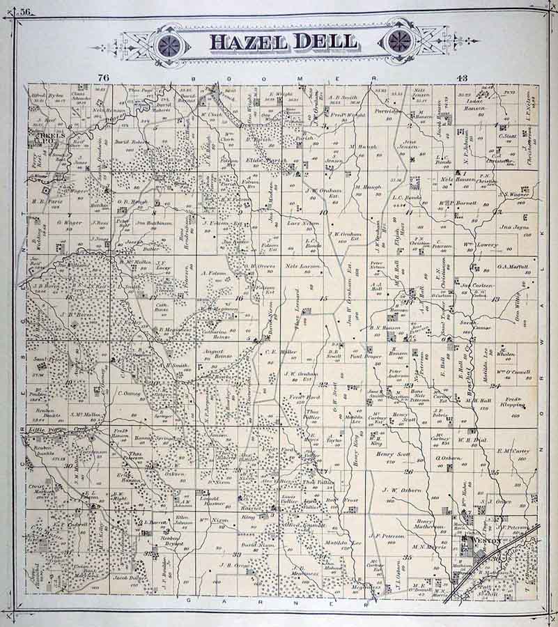
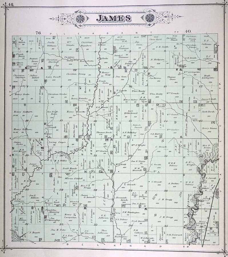
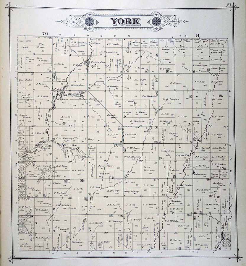
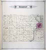
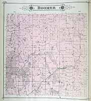
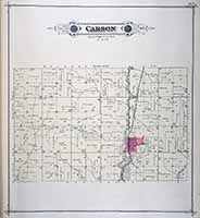
Plat Maps
1885
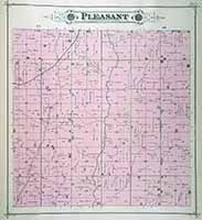
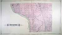
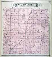
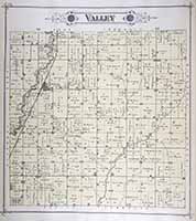
Click on map to enlarge, then click map again to see landowner's name.
(Illustrated Atlas of Pottawattamie County, Iowa, 1885 - online at the Univ. of Iowa, Digital Library)
BELKNAP
|
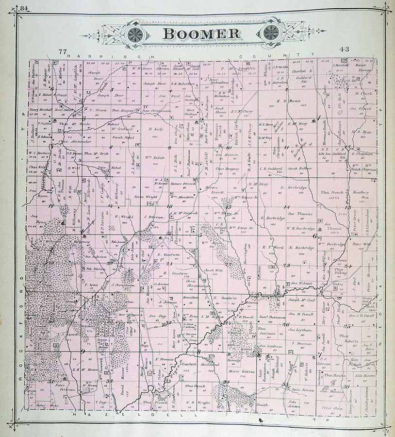
BOOMER
|
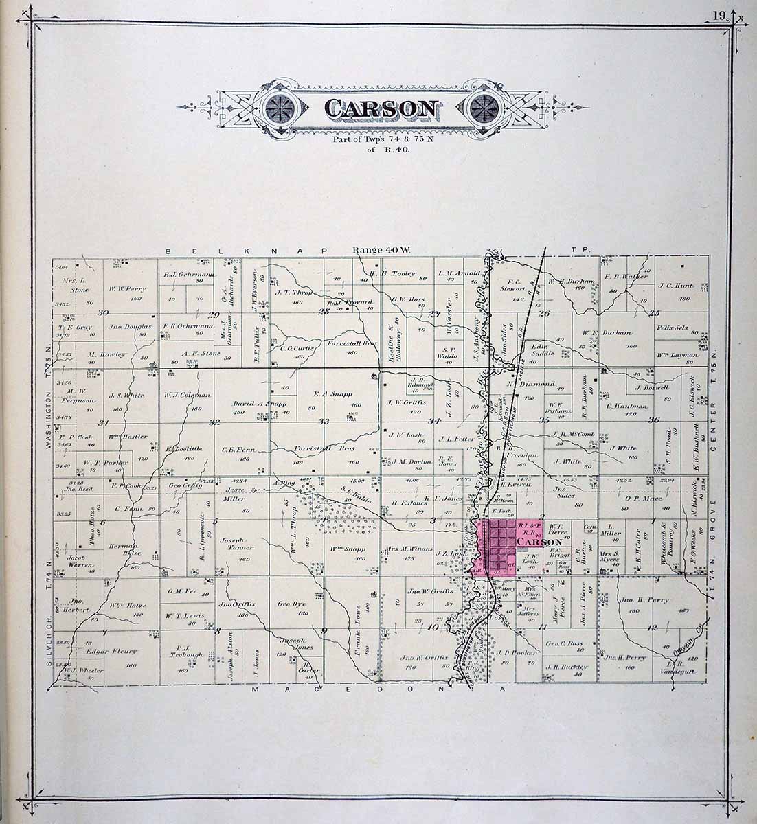
CARSON
|
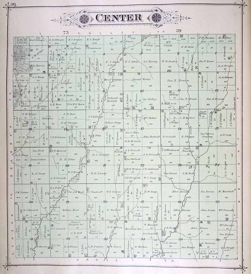
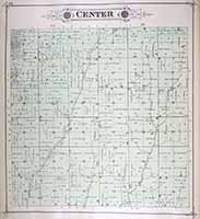
CENTER
|
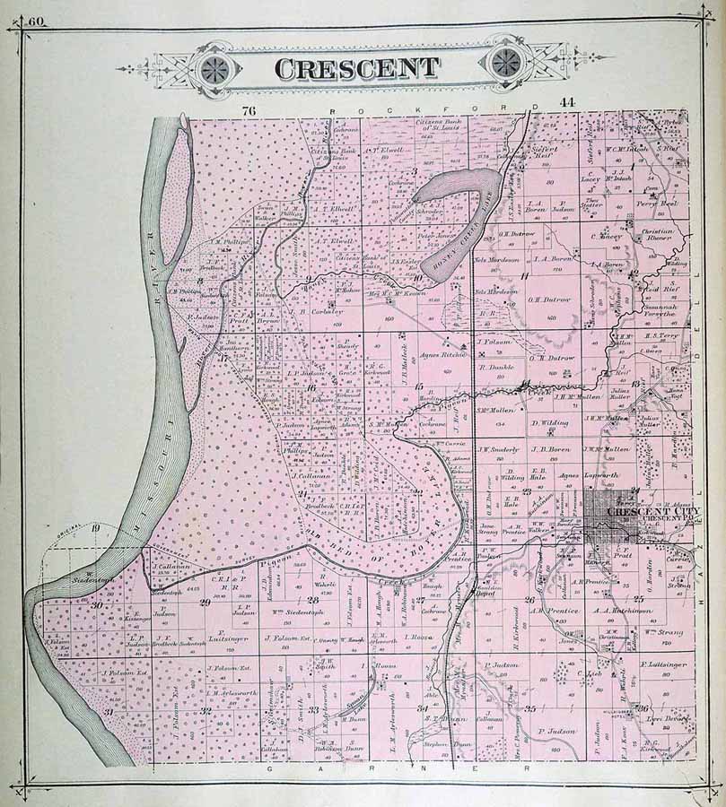
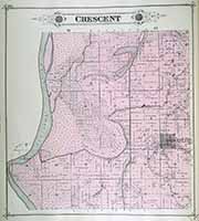
CRESCENT
|
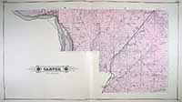
GARNER
|
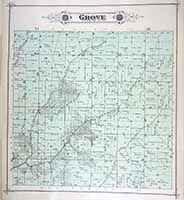
GROVE
|
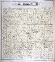
HARDIN
|
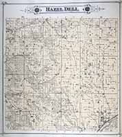
HAZEL
DELL
|
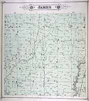
JAMES
|
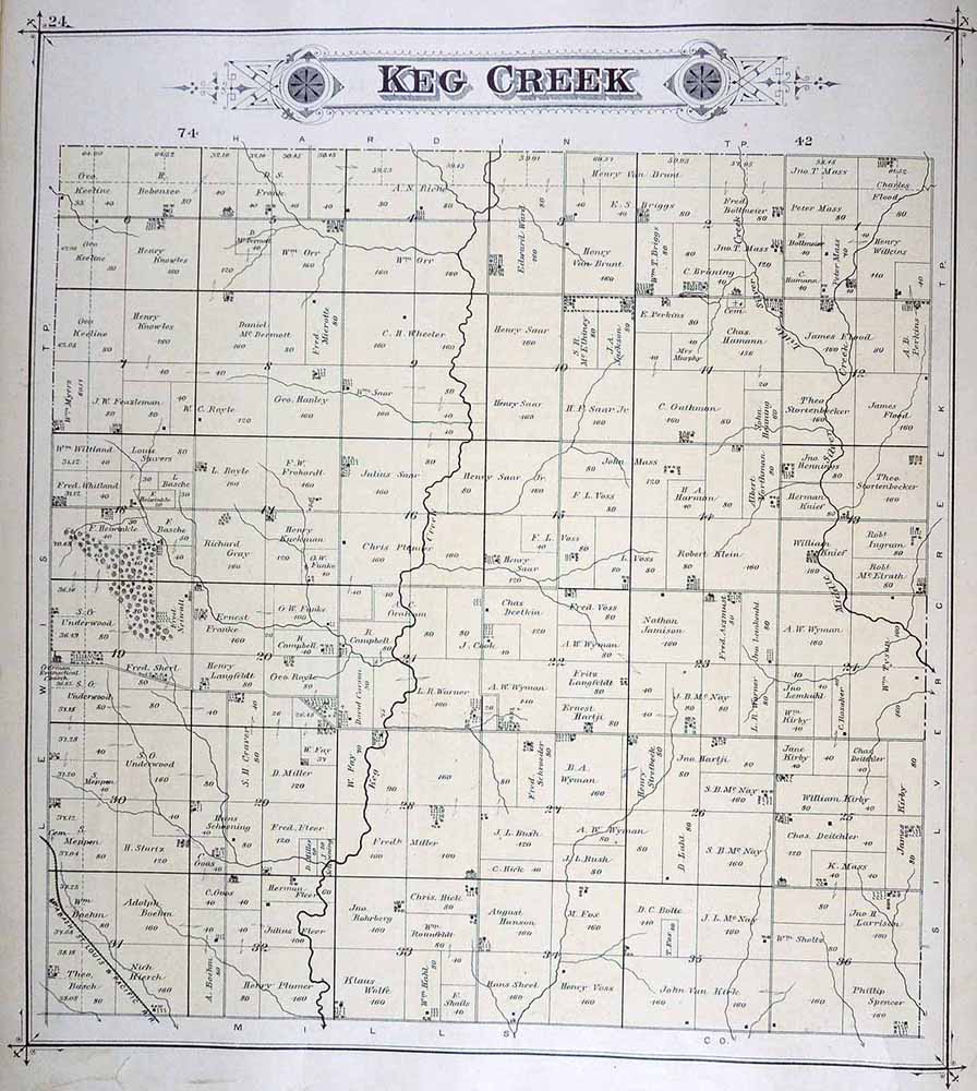
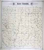
KEG
CREEK
|
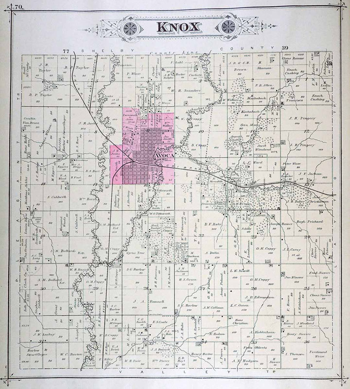
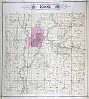
KNOX
|
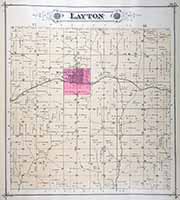
LAYTON
|
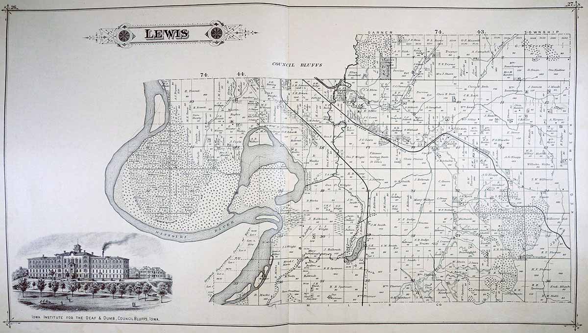
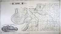
LEWIS
|
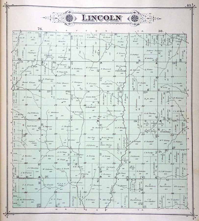
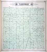
LINCOLN
|
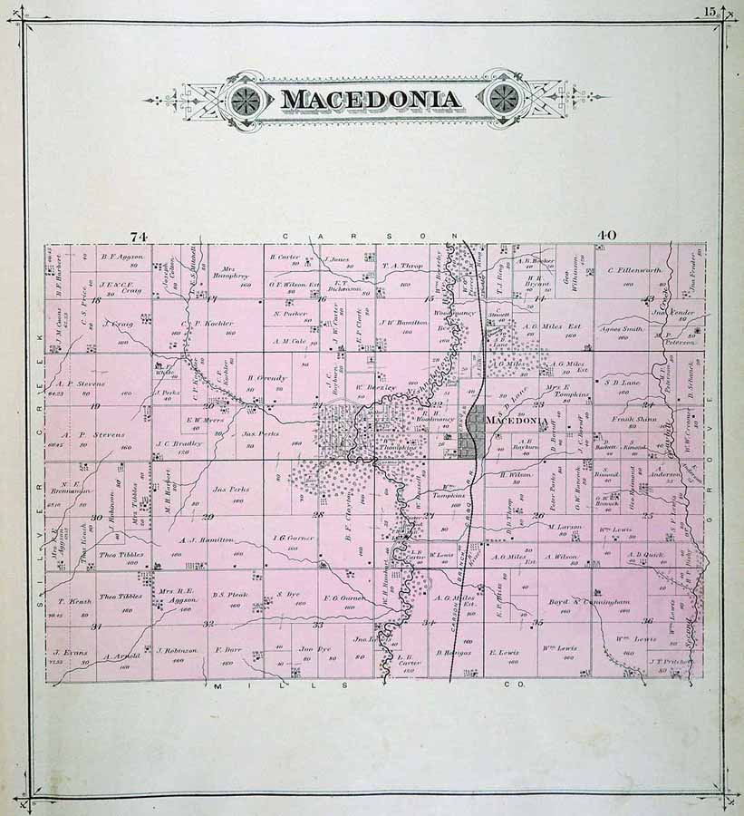
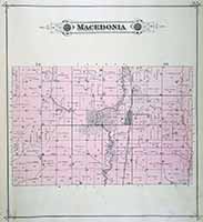
MACEDONIA
|
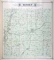
MINDEN
|
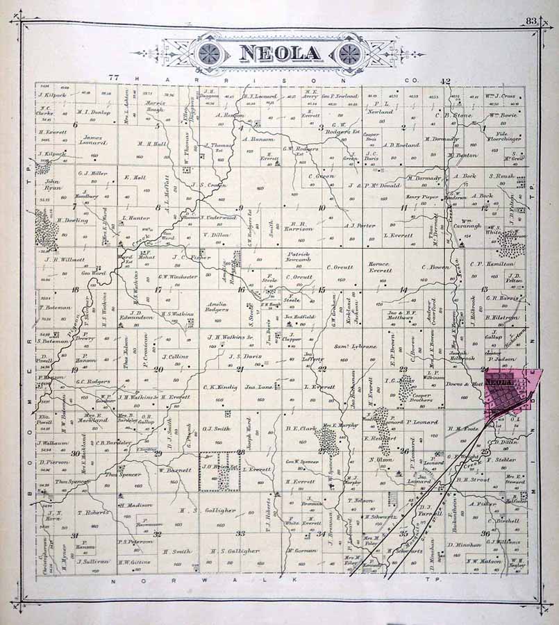
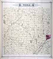
NEOLA
|
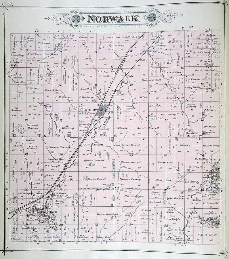
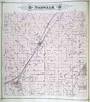
NORWALK
|
PLEASANT
|
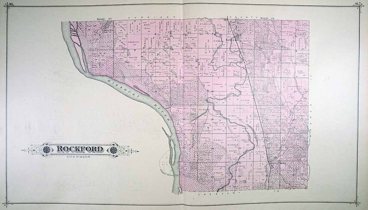
ROCKFORD
|
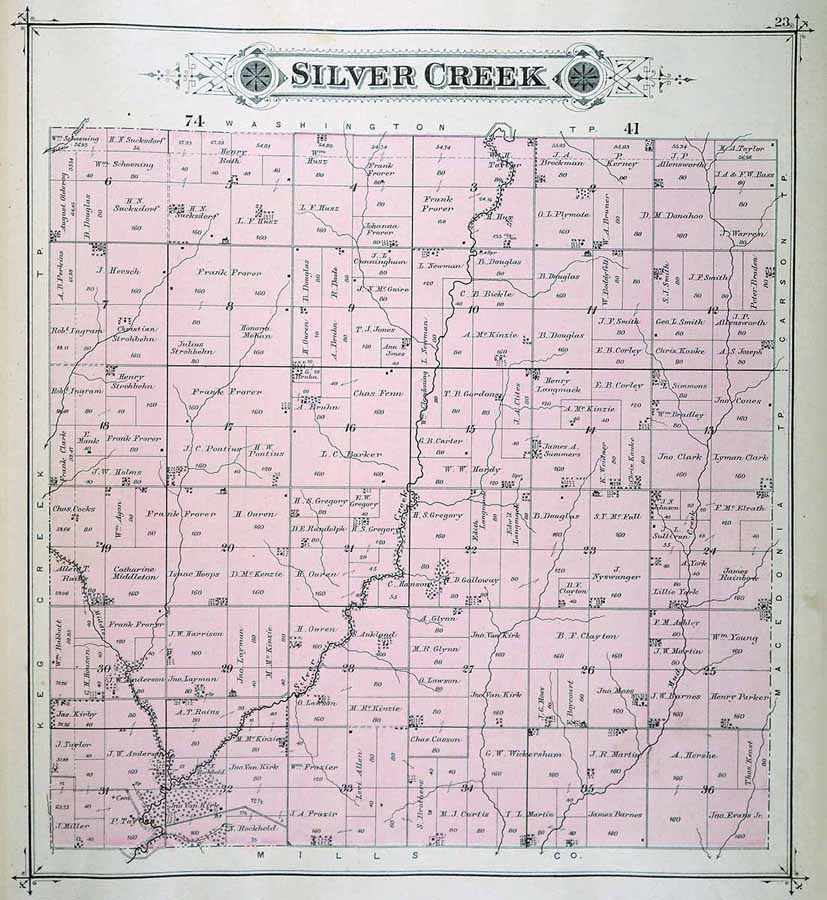
SILVER
CREEK
|
VALLEY
|
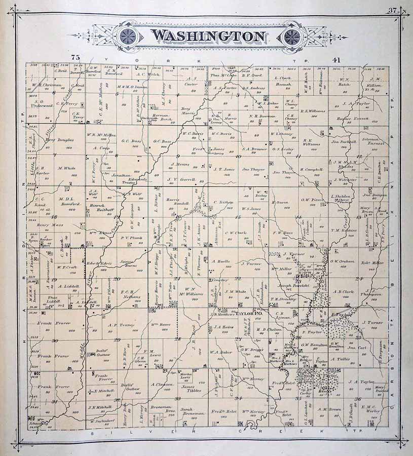
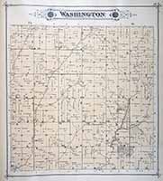
WASHINGTON
|
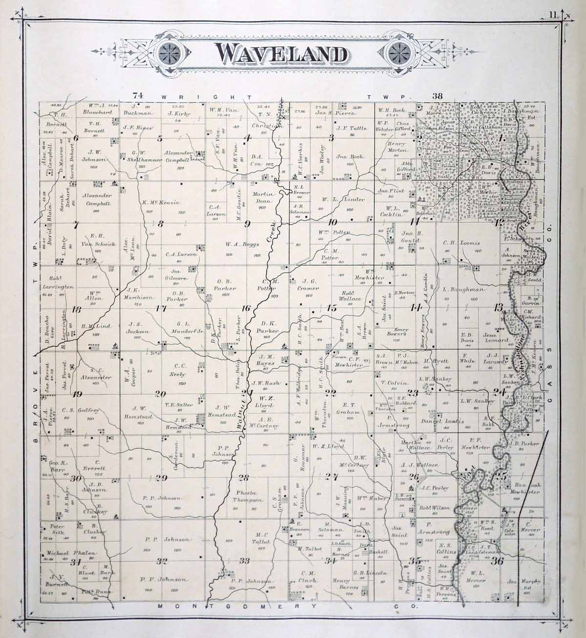
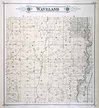
WAVELAND
|
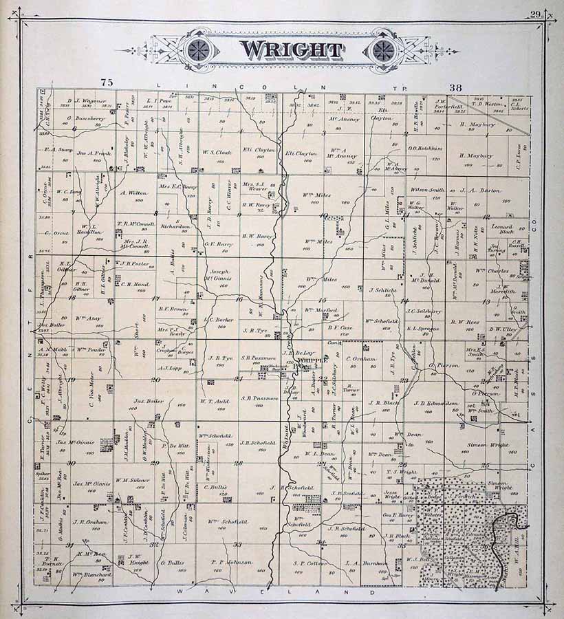
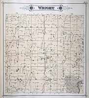
WRIGHT
|
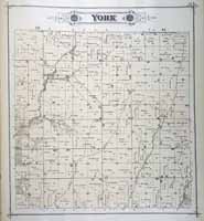
YORK
|
|
|
|
|
Illustrated Atlas of
Pottawattamie County, Iowa. Council Bluffs: C. R. Allen, 1885, in the
State Historical Society of Iowa (Iowa City) Collection. Available
through the Iowa Digital Library. Used with permission of the
University of Iowa Libraries. |
|
|