Johnson County IAGenWeb Project
History of Johnson County
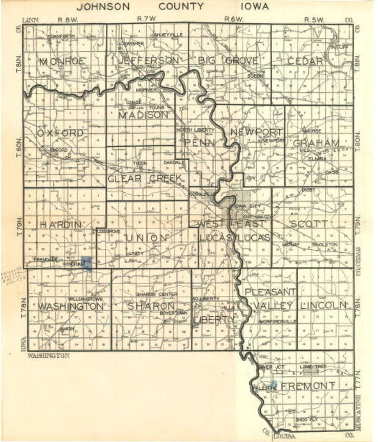
1930 JOHNSON COUNTY PLAT BOOK
County
Map
(Click on image to enlarge)
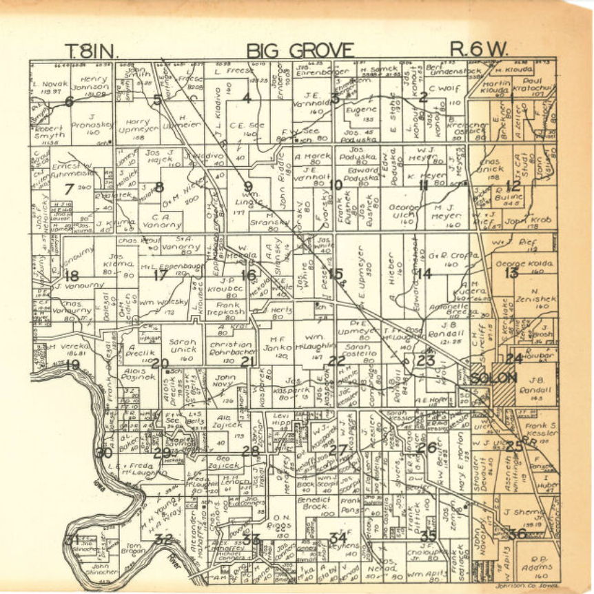
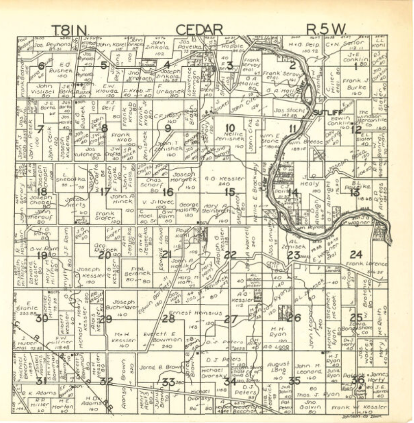
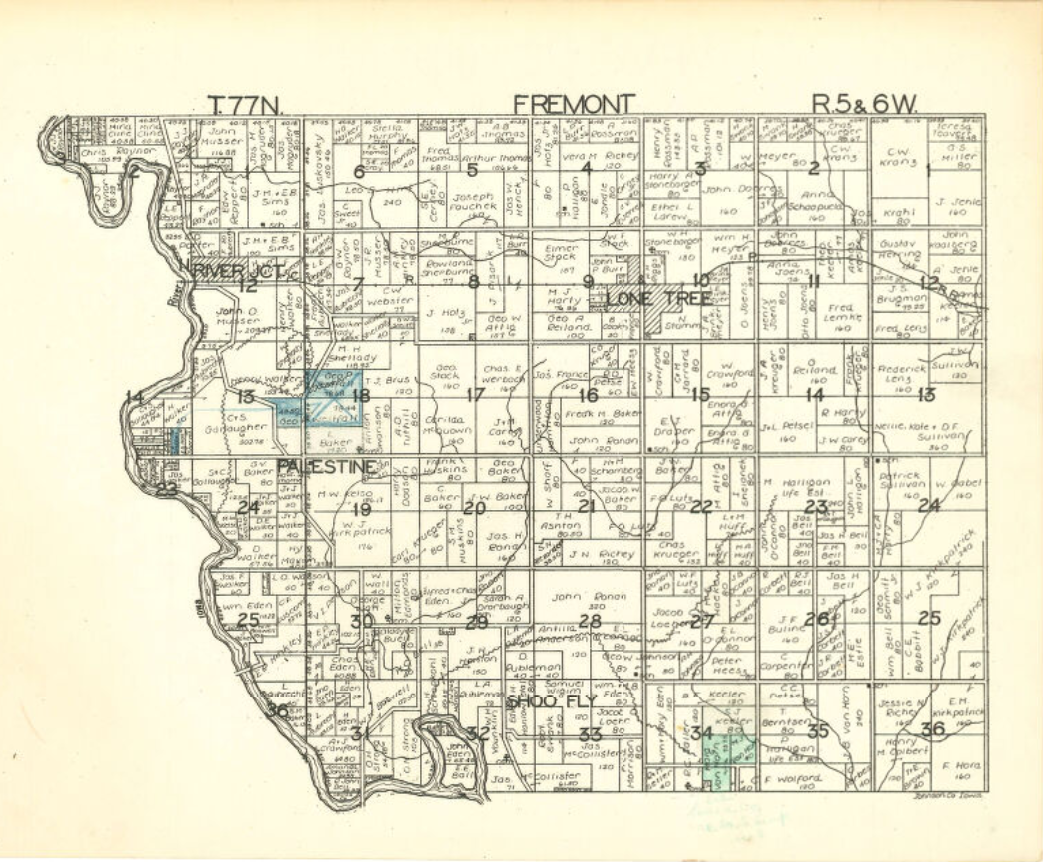
Township
Maps
(Click on images below to enlarge)
Big Grove
Cedar
Clear Creek
Fremont
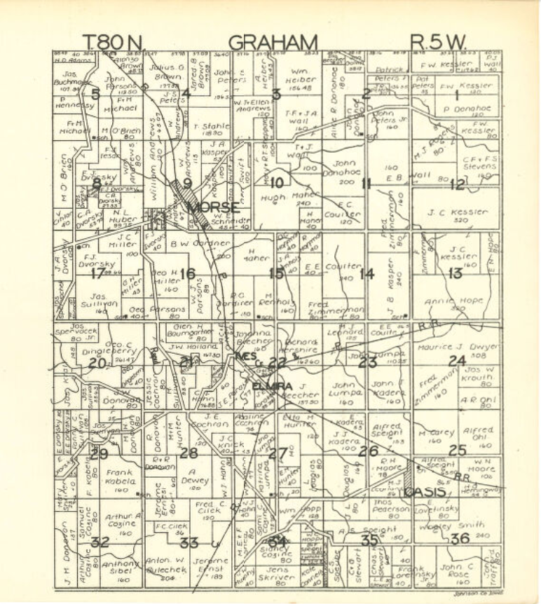
Graham
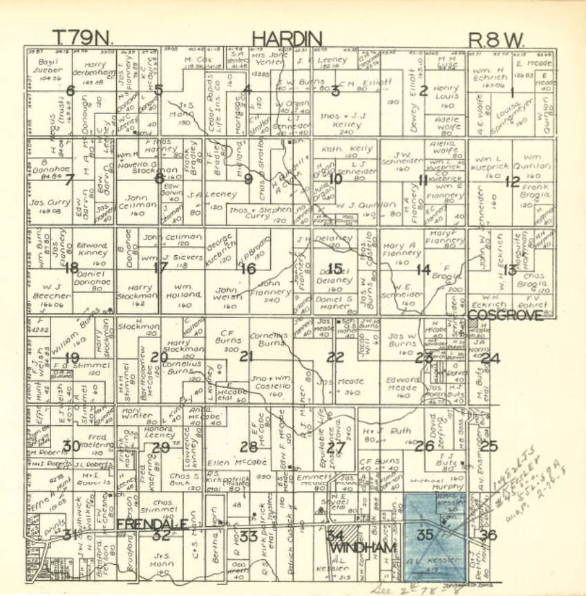
Hardin
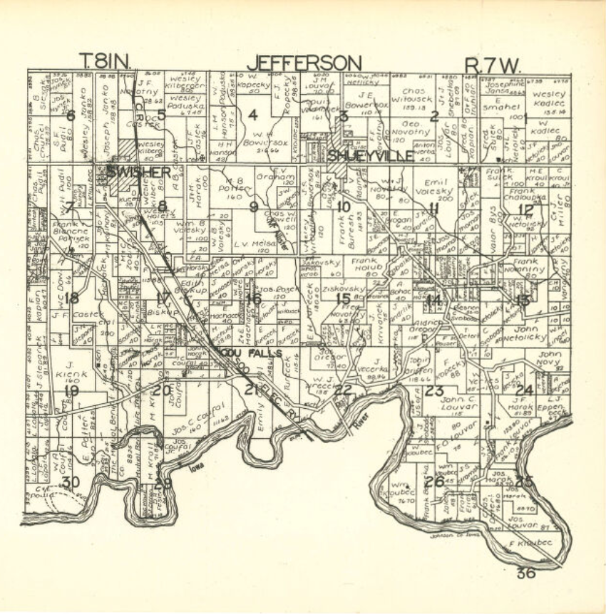
Jefferson
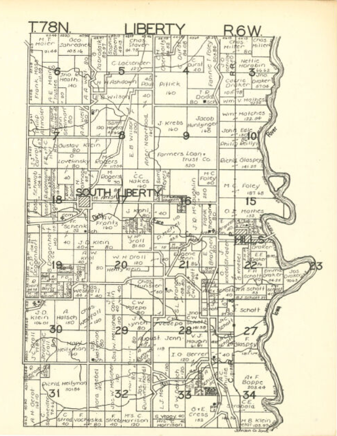
Liberty
Lincoln
Lucas
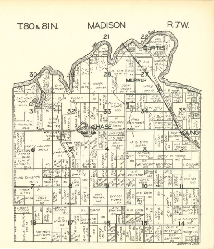
Madison
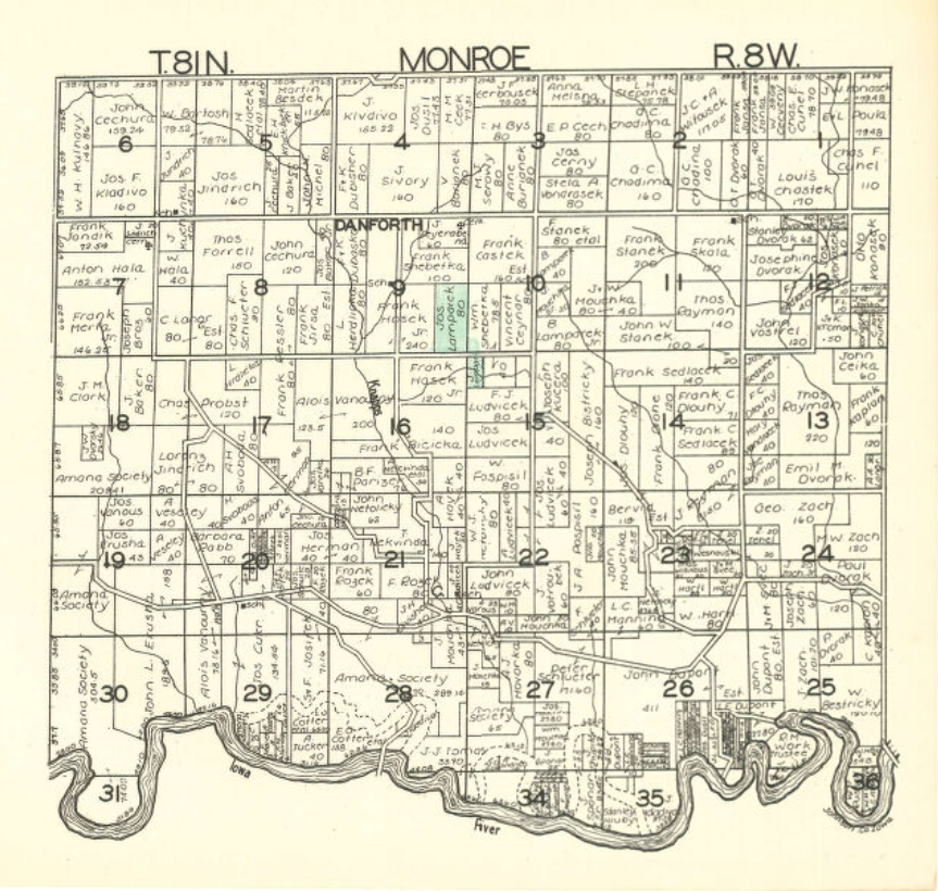
Monroe
Newport
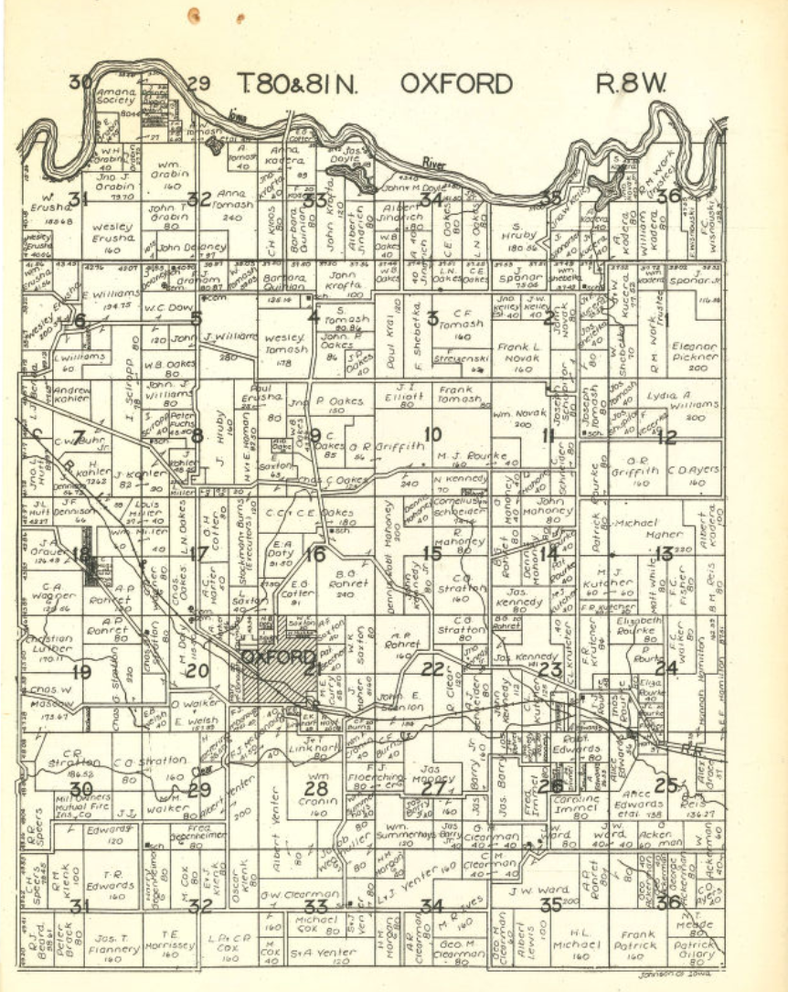
Oxford
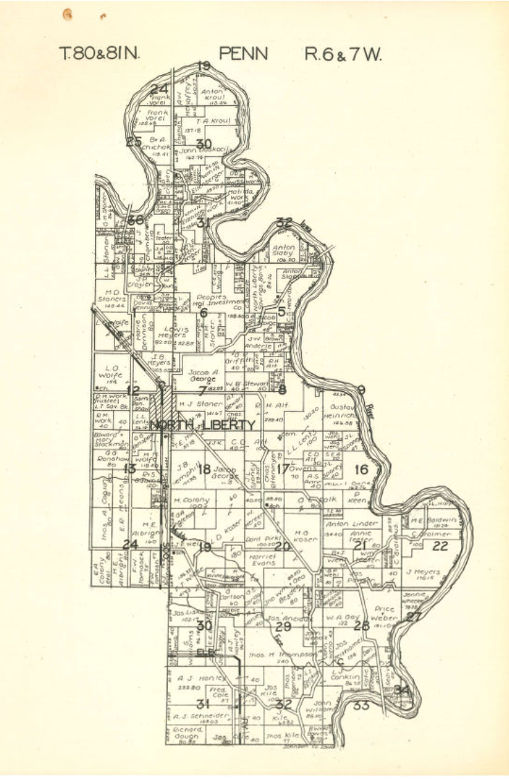
Penn
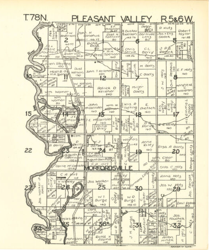
Pleasant Valley
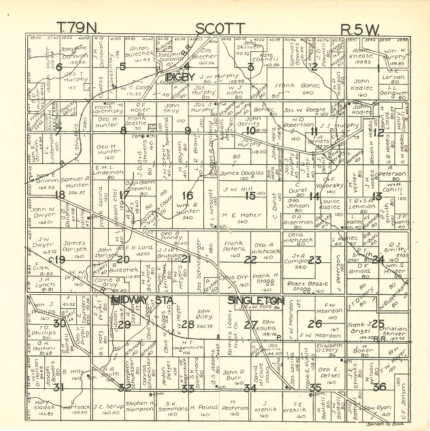
Scott
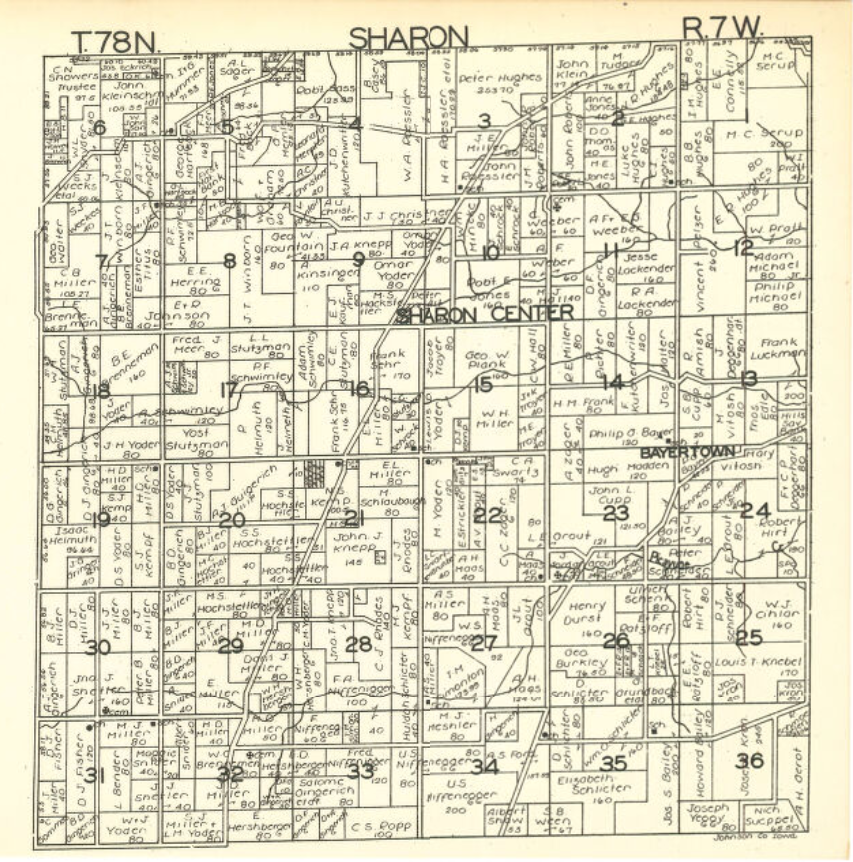
Sharon
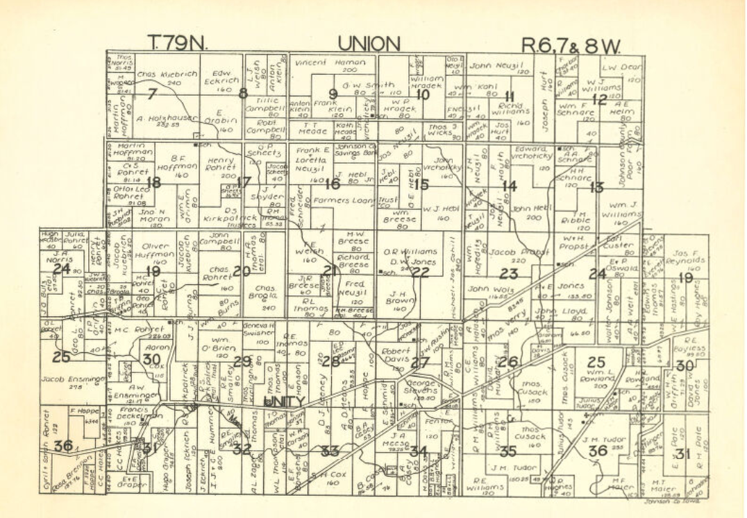
Union
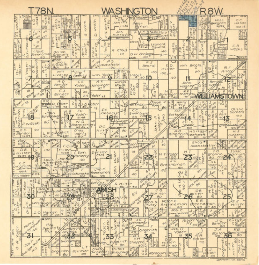
Washington
Source: “Plat book of Johnson County, Iowa, 1930, Plat book of Johnson County, Iowa, 1930”. Atlases, plat books. Hixson Plat Map Atlases of Iowa. https://digital.lib.uiowa.edu/node/23819.
Return To Home Page